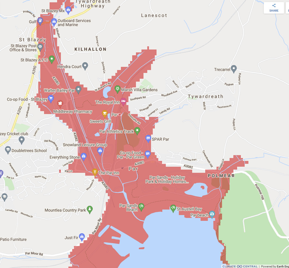
The website Climate Central came in for a bit of stick from the BBC R4 programme More or Less on 1.7.21. It shows maps of the world together with their liability to flooding from sea level rise. On the site it looks as if most of Holland and surprisingly large areas of the UK will be under water on one of its default maps, 'Land projected to be below Annual Flood Level in 2050'.
We would be the last to want to understate the potential impact of sea level rise, but there is a lack of clarity here. The explanation lies in the fact that outside the USA, the site does not take account of existing or planned sea defences. However, that is exactly the situation in Par - it has no such, merely a low-lying beach, and there are no plans to build any; too costly. So although it is simply computer-generated from elevation data in Google maps, this image, taken from the site, may well be a reasonably accurate forecast of what will happen in due course given the coincidence of a storm surge and seas rising at 4.5mm per annum - or more.